


WNIJ invited author Dan Libman to write about the centenary of Lincoln Highway, America's first coast-to-coast highway. Libman borrowed a WNIJ recorder and traveled the highway in March - on his bicycle. In Part One of our 3-part series, Libman stops at the Lincoln Highway Association's headquarters in Franklin Grove, IL. He also followed the highway through Dixon and Sterling. WNIJ's Dan Klefstad produced the audio version of this report, which you can hear by clicking the above link. Here's Libman's first essay:
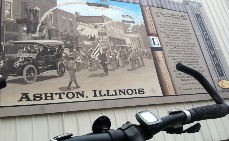
The speed limit on most of Lincoln Highway is 55 miles an hour. If you’re rushing past Kishwaukee College or heading out toward Rochelle at that speed, you’re likely to miss a few things. You might not notice the many placards or commemorative murals hidden like Easter eggs, which reveal themselves only to slower travelers. You might not that be aware that your tires are going over the spot where the first-ever experimental bit of cement was laid on the first trans-national highway in America. And driving at 55 miles an hour in 2013, you certainly wouldn’t get a sense of what a dicey proposition it was to attempt a cross-country journey 100 hundred years ago when the road was first completed.
But you might be able to get a feeling for it if you pedaled Lincoln Highway on a bicycle.
The 1916 Official Road Guide deemed traveling Lincoln Highway, quote, “something of a sporting proposition,” and added that motorists should not attempt it in new shoes. If a driver could stand being bumped and jostled a full six hours every day at the recommended 18-miles-an-hour speed limit, it would take no less than a month — and that’s if you were lucky enough to find regular oil, fuel, food and hotels, all of which were scarce in the middle states and positively nonexistent in parts of the west. What should a driver pack? The guide recommends chains, for starters. As well as jacks, tires and tubes, shovels and even a pickaxe.
In March 2013, when I set off to ride my bicycle on the Lincoln Highway, I too carried a spare tube in my saddle bag. Also Cliff bars, water bottles, a cell phone and, because I was traveling for WNIJ, a microphone and state-of-the-art recording equipment.
The 10-mile leg from the Lincoln Highway Association in Franklin Grove into Dixon is rural and pleasant on a bicycle, despite being on busy Route 38 for most of it. Here the shoulder is wide enough to feel safe, even with motor traffic going by quickly. The leisurely traveler might pause to look at the single- and double-acre cemeteries, rolling hills with farmland, a variety of scattered homes — brick bungalows mixed in with newer ranch homes right next to dilapidated barns and farm buildings. A little microcosm of Midwest scenery. Large grain elevators dot the landscape near Nachusa. While the Midwest might feel flat when cruising in your car, here on a bicycle you quickly realize it’s actually pretty hilly, with gentle undulations that get more pronounced the closer you pedal toward the Rock River. When the road rises, you can see Interstate 88 off in the distance — the big superhighway that pretty much put Lincoln Highway and its noisier cousin, Route 66, out of business.
American’s first highway was named for President Lincoln as a calculated public-relations move by the planners of the road — a coalition of private citizens. The moniker proved a savvy choice. One brave early traveler wrote, “With such titles as ‘Transcontinental’ and ‘Lincoln’ put before it, you dream of a wide straight road like the Route Nationale of France.” It wasn’t until much later that the highway system grew so large that numbers would be required instead of names. I’m reminded of this just after the iconic Dixon Arch, which I pedal under as Lincoln Highway leaves Route 38 and becomes Route 52. Sights from the Lincoln Highway in Dixon include a U.S. Army helicopter parked in front of the VFW, the arch, a replica chunk of the Berlin wall and, finally, a crossing over the Rock River. This bridge, while wide and fine for motor traffic, was not safe for bicycles and on my way back I used the pedestrian bridge just to the west.
At the Veteran’s Memorial in Dixon, Lincoln Highway turns onto a picturesque road called Palmyra. This dogleg from Dixon to Sterling takes travelers off the main drag and onto a hilly, tree-lined street with a lot of character. Small family homes and farmland dot the landscape, which begins as a climb past a shuttered bar called The White House. This part of the journey almost feels like a step back in time. Palmyra Road is one of two places I rode where you could, with a little imagination, see what Lincoln Highway was like 100 years ago. Sure enough, I’m soon passing the giant movie screen of the Midway, an actual old-fashioned drive-in theater still in operation.
Sterling is a delightful old town with a quaint, aging rust-belt feel, charmingly run-down buildings, and a lively, vibrant downtown area. The original Lincoln Highway Association offered incentives for towns which would agree to honor President Lincoln, and Sterling boasts a statue of the 16th president. Right across the street from a Lincoln Park, I stopped for lunch at a drive-in called the Dairy Mart, which features Mexican and Asian foods. Because I was quite hungry after the ride, I sampled a lot: tacos, and Thai stuffed chicken wings with pork fried rice. Something about that combination says a lot about Sterling, and the food was delicious — well worth the ride.

Listen for Part 2 of "Pedaling Lincoln Highway" Thursday during Morning Edition on WNIJ. The series continues after NPR news at 6:30 and 8:30. Then check back here for Libman's full essay, and more pictures.


